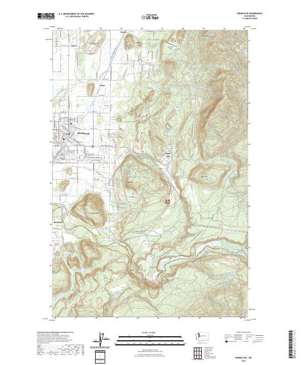
2023 Map of Enumclaw
USGS Topo · Published 2023About this map
Enumclaw and Buckley anchor this modern survey, where the valley floor meets the rising timbered slopes of the Cascade foothills. The urban grid of Enumclaw contrasts with the surrounding rural landscape, marked by small settlements like Veazie, Krain, and Birch. The White River carves a deep path along the southern boundary, separating King and Pierce counties, while the massive topographic bulk of Mud Mtn and the sharp rise of Pinnacle Peak dominate the southern half of the sheet. Industrial and aviation history is represented by the Upper Mill and Bergseth Field, alongside a complex network of timber management roads like the Weyerhauser Mainline Rd. Numerous water bodies, including First Lake, Second Lake, and Third Lake, are scattered across the hills near Enumclaw Mtn, illustrating the intricate drainage system feeding into Newaukum Creek and Boise Creek.
Find a feature on this map
56 named features on this map. Tap any name to fly to it.
Don’t see what you’re looking for? This feature index may not catch every label — zoom into the map to look around manually.
Map Details
Editions of this 2023 Enumclaw Map
This is the sole edition of this map. No revisions or reprints were ever made.
Other maps of this area

1897 · Tacoma
USGS Topo · 1:125,000

1900 · Tacoma
USGS Topo · 1:125,000

1913 · Cedar Lake
USGS Topo · 1:125,000

1942 · Lake Tapps
USGS Topo · 1:62,500

1944 · Lake Tapps
USGS Topo · 1:62,500

1949 · Black Diamond
USGS Topo · 1:24,000

1953 · Eagle Gorge
USGS Topo · 1:24,000

1953 · Cumberland
USGS Topo · 1:24,000
1956 · Buckley
USGS Topo · 1:24,000
1956 · Wilkeson
USGS Topo · 1:24,000