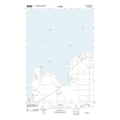
2010 Map of Ephraim
USGS Topo · Published 2010About this map
Ephraim and Fish Creek define the western shoreline of the Door County peninsula along Green Bay and Lake Michigan. The landscape is marked by prominent coastal features including Eagle Bluff, where the Eagle Bluff Light serves as a navigational landmark, and the nearby Horseshoe Island. Further north, Sister Islands and Sister Shoals pose maritime challenges offshore from Sister Bluffs.
Find a feature on this map
40 named features on this map. Tap any name to fly to it.
Don’t see what you’re looking for? This feature index may not catch every label — zoom into the map to look around manually.
Map Details
Editions of this 2010 Ephraim Map
This is the sole edition of this map. No revisions or reprints were ever made.
Other maps of this area

1954 · Escanaba
USGS Topo · 1:250,000

1957 · Escanaba
USGS Topo · 1:250,000

1958 · Escanaba
USGS Topo · 1:250,000

1960 · Sister Bay
USGS Topo · 1:62,500

1960 · Ellison Bay
USGS Topo · 1:62,500

1961 · Chambers Island
USGS Topo · 1:62,500

1963 · Cedar River
USGS Topo · 1:62,500

1981 · Marinette
USGS Topo · 1:100,000
1982 · Baileys Harbor West
USGS Topo · 1:24,000
1982 · Ellison Bay
USGS Topo · 1:24,000