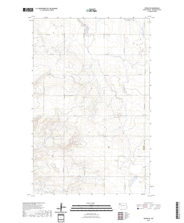
2024 Map of Epping NE
USGS Topo · Published 2024About this map
The Little Muddy River winds through the northern sections of this Williams County landscape, carving a subtle valley through the high plains of western North Dakota. This contemporary topographical record illustrates the persistent grid of the Public Land Survey System, with township boundaries for t158n r98w, t158n r97w, t157n r98w, and t157n r97w meeting here. The map reveals the modern rural infrastructure of the region, where gravel and section-line roads like Co Rd 10 and 120th Ave NW facilitate access across the undulating terrain. While predominantly a study of natural drainage and land division, the survey highlights the sparse, systematic development of the area northeast of Epping, showing how contemporary transportation networks like 74th St NW follow the historic township lines established over a century ago.
Find a feature on this map
18 named features on this map. Tap any name to fly to it.
Don’t see what you’re looking for? This feature index may not catch every label — zoom into the map to look around manually.
Map Details
Editions of this 2024 Epping NE Map
This is the sole edition of this map. No revisions or reprints were ever made.
Other maps of this area

1911 · Ray
USGS Topo · 1:125,000

1953 · Williston
USGS Topo · 1:250,000

1957 · Williston
USGS Topo · 1:250,000

1974 · Tom Berg Lake
USGS Topo · 1:24,000

1977 · Alamo
USGS Topo · 1:24,000

1978 · Corinth
USGS Topo · 1:24,000

1978 · Ray
USGS Topo · 1:24,000

1978 · Epping NW
USGS Topo · 1:24,000

1978 · Ray NW
USGS Topo · 1:24,000
1978 · Epping NE
USGS Topo · 1:24,000