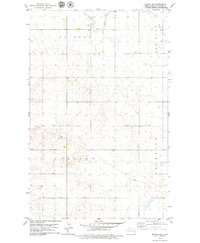
1978 Map of Epping NE
USGS Topo · Published 1979About this map
The Little Muddy River winds through this Williams County landscape, carving a valley across northern North Dakota during the late 1970s. The map illustrates a strictly rural organization of the land, defined by sprawling township boundaries such as Rainbow, New Home, Oliver, and Champion. These legal divisions provide a glimpse into the administrative structure of the high plains, where large-scale ranching and agriculture are the primary human imprints.
Find a feature on this map
9 named features on this map. Tap any name to fly to it.
Don’t see what you’re looking for? This feature index may not catch every label — zoom into the map to look around manually.
Map Details
Editions of this 1978 Epping NE Map
This is the sole edition of this map. No revisions or reprints were ever made.
Other maps of this area

1911 · Ray
USGS Topo · 1:125,000

1953 · Williston
USGS Topo · 1:250,000

1957 · Williston
USGS Topo · 1:250,000

1974 · Tom Berg Lake
USGS Topo · 1:24,000

1977 · Alamo
USGS Topo · 1:24,000

1978 · Corinth
USGS Topo · 1:24,000

1978 · Ray
USGS Topo · 1:24,000

1978 · Epping NW
USGS Topo · 1:24,000

1978 · Ray NW
USGS Topo · 1:24,000

1978 · Epping
USGS Topo · 1:24,000