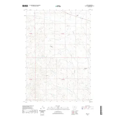
2020 Map of Epsie
USGS Topo · Published 2020About this map
Epsie stands in the northeastern corner of this Montana landscape, where the high plains are carved by an intricate network of intermittent watercourses. The local geography is defined by prominent topographical landmarks including Mc Allister Butte, Castle Rock, and Rattlesnake Butte, which rise above the surrounding drainage basins. This area is heavily influenced by the Mizpah Cr system, which collects numerous tributaries such as Two Tree Cr, Serviceberry Cr, and the northern reaches of Rock Springs Cr. Movement through this Powder River County terrain is primarily facilitated by local routes like Burley Rd and Rice Rd, which follow the natural contours of the ridges and valleys. The map illustrates a ranching and grazing environment where named water sources, such as Dripping Spring Cr and Sanders Cr, are vital landmarks for navigation and land use.
Find a feature on this map
21 named features on this map. Tap any name to fly to it.
Don’t see what you’re looking for? This feature index may not catch every label — zoom into the map to look around manually.
Map Details
Editions of this 2020 Epsie Map
This is the sole edition of this map. No revisions or reprints were ever made.
Other maps of this area

1954 · Ekalaka
USGS Topo · 1:250,000

1956 · Ekalaka
USGS Topo · 1:250,000

1958 · Ekalaka
USGS Topo · 1:250,000

1965 · Ekalaka
USGS Topo · 1:250,000

1966 · Sonnette
USGS Topo · 1:24,000

1966 · Hodsdon Flats
USGS Topo · 1:24,000

1966 · Samuelson Ranch
USGS Topo · 1:24,000

1973 · Olive
USGS Topo · 1:24,000

1973 · Lonesome Peak
USGS Topo · 1:24,000
1973 · Yarger Butte
USGS Topo · 1:24,000