
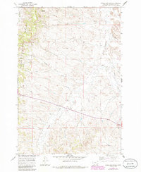
1966 Map of Samuelson Ranch
USGS Topo · Published 1970About this map
Custer National Forest borders the western edge of this Powder River County landscape, where the terrain shifts from timbered breaks into a complex network of drainage basins. The ranching economy of the mid-1960s is centered on namesake landmarks like the Samuelson Ranch and essential water sources such as Cain Spring and Manning Spring. The southeastern portion of the map is defined by the winding course of Pumpkin Creek, which is fed by numerous seasonal tributaries including Titus Creek and Winter Gulch. Evidence of local infrastructure and community life is anchored by the Camps Pass Sch, situated along an unimproved road near a Gravel Pit. This survey captures a specific era of high-plains land use, where scattered wells and small creeks like Short Creek and Sixmile Creek supported isolated ranching operations across the rolling Montana prairie.
Find a feature on this map
14 named features on this map. Tap any name to fly to it.
Don’t see what you’re looking for? This feature index may not catch every label — zoom into the map to look around manually.
Map Details
Editions of this 1966 Samuelson Ranch Map
2 editions found
Other maps of this area

1954 · Ekalaka
USGS Topo · 1:250,000

1956 · Ekalaka
USGS Topo · 1:250,000

1958 · Ekalaka
USGS Topo · 1:250,000

1965 · Ekalaka
USGS Topo · 1:250,000

1966 · Sonnette
USGS Topo · 1:24,000

1966 · Stacey
USGS Topo · 1:24,000

1966 · Home Creek Butte
USGS Topo · 1:24,000

1966 · Threemile Buttes
USGS Topo · 1:24,000

1966 · Elk Ridge
USGS Topo · 1:24,000

1973 · Box Elder Creek
USGS Topo · 1:24,000