
1966 Map of Elk Ridge
USGS Topo · Published 1970About this map
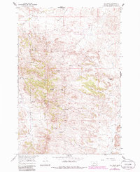
The Custer National Forest encompasses the central ridgelines of this Powder River County landscape, defined by the prominent Elk Ridge and the Griffin Pass gap. This mid-1960s survey reveals a landscape heavily engineered for water management in an arid environment, characterized by numerous small-scale water improvements like Coal Creek Reservoir, Williams Reservoir, and Cameron Reservoir. These features, alongside named locations such as Gold Well and Manning Well, suggest a region focused on livestock grazing and ranching operations. Educational infrastructure is represented by the isolated Horkan Creek Sch in the northern portion of the quadrangle. The terrain is deeply dissected by drainages including Little Pumpkin Creek and Kiwah Creek, with a single Jeep Trail providing access through the rugged timbered interior.
Find a feature on this map
34 named features on this map. Tap any name to fly to it.
Don’t see what you’re looking for? This feature index may not catch every label — zoom into the map to look around manually.
Map Details
Editions of this 1966 Elk Ridge Map
2 editions found
Other maps of this area

1954 · Ekalaka
USGS Topo · 1:250,000

1956 · Ekalaka
USGS Topo · 1:250,000

1958 · Ekalaka
USGS Topo · 1:250,000

1965 · Ekalaka
USGS Topo · 1:250,000

1966 · Stacey
USGS Topo · 1:24,000

1966 · Home Creek Butte
USGS Topo · 1:24,000

1966 · Samuelson Ranch
USGS Topo · 1:24,000
1973 · North Stacey School
USGS Topo · 1:24,000

1973 · Box Elder Creek
USGS Topo · 1:24,000
1973 · Foster Creek School
USGS Topo · 1:24,000