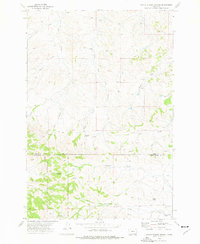
1973 Map of North Stacey School
USGS Topo · Published 1976About this map
The Custer National Forest boundary marks the southern portion of this Montana survey, where the rugged drainage basins of the Powder River watershed are meticulously documented. The landscape is defined by its seasonal hydrology, featuring numerous named springs such as Bathtub Spring and Red Shale Spring, alongside the winding courses of Starvation Creek and Foster Creek. The presence of the North Stacey School and the nearby North Stacey Cem provides a clear focal point for genealogists and local historians, anchoring the dispersed ranching community of the era. To the north, the terrain transitions into a complex of coulees and ridges, including the prominent landmark Castle Rock. Cattle trails and a Jeep Trail navigate the topographical shifts between the South Fork Foster Creek and Mullins Coulee, reflecting a landscape geared toward livestock and resource management. This mid-1970s record preserves the specific locations of isolated infrastructure, from remote wells to the Liscom Mtn Spring.
Find a feature on this map
24 named features on this map. Tap any name to fly to it.
Don’t see what you’re looking for? This feature index may not catch every label — zoom into the map to look around manually.
Map Details
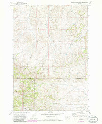
Editions of this 1973 North Stacey School Map
2 editions found
Other maps of this area

1954 · Hardin
USGS Topo · 1:250,000

1954 · Ekalaka
USGS Topo · 1:250,000

1956 · Ekalaka
USGS Topo · 1:250,000

1957 · Hardin
USGS Topo · 1:250,000

1958 · Ekalaka
USGS Topo · 1:250,000

1958 · Hardin
USGS Topo · 1:250,000

1965 · Ekalaka
USGS Topo · 1:250,000

1966 · Stacey
USGS Topo · 1:24,000

1966 · Beaver Creek School
USGS Topo · 1:24,000

1966 · Elk Ridge
USGS Topo · 1:24,000