
1966 Map of Beaver Creek School
USGS Topo · Published 1969About this map
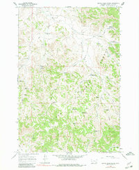
Beaver Creek School stands as a focal point in this 1966 field-checked survey of Powder River County, Montana. The landscape is defined by the expansive Custer National Forest and a complex drainage system where Beaver Creek and Ash Creek meet. This era in the region’s development is marked by an extensive water-management network for ranching, featuring multiple catchment points like the Main Ash Reservoir, Schiller Reservoir, and a sequence of sites including Deer Creek Reservoir No 1. A lonely Grave recorded in the hills near Cabin Creek provides a poignant point of interest for genealogists and local historians. The presence of numerous wells, such as the Cabin Creek Well and Maxwell Well, underscores the critical importance of water access in this semi-arid rangeland before modern infrastructure transformed the local livestock industry.
Find a feature on this map
42 named features on this map. Tap any name to fly to it.
Don’t see what you’re looking for? This feature index may not catch every label — zoom into the map to look around manually.
Map Details
Editions of this 1966 Beaver Creek School Map
3 editions found
Other maps of this area

1954 · Hardin
USGS Topo · 1:250,000

1954 · Ekalaka
USGS Topo · 1:250,000

1956 · Ekalaka
USGS Topo · 1:250,000

1957 · Hardin
USGS Topo · 1:250,000

1958 · Ekalaka
USGS Topo · 1:250,000

1958 · Hardin
USGS Topo · 1:250,000

1965 · Ekalaka
USGS Topo · 1:250,000

1966 · Coleman Draw
USGS Topo · 1:24,000

1966 · Stacey
USGS Topo · 1:24,000

1966 · Home Creek Butte
USGS Topo · 1:24,000