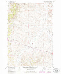
1966 Map of Samuelson Ranch
USGS Topo · Published 1986About this map
Custer National Forest encompasses the western heights of this region, where the rugged drainages of Winter Gulch and Titus Gulch define the high desert topography. This 1966 field-checked survey reveals a sparsely settled landscape centered on the Samuelson Ranch, illustrating the remote ranching operations and essential water management required in this corner of Montana. The importance of reliable water sources is evident in the numerous features such as Manning Spring, Cain Spring, and the Cain Well, which sustained livestock and homesteads across the drainage of Pumpkin Creek. The presence of the Camps Pass Sch south of the ranch provides a glimpse into the rural community infrastructure that served isolated families. As the map was photorevised in 1985, it documents the transition of secondary road networks and small-scale land use like the Gravel Pit during the latter half of the 20th century.
Find a feature on this map
18 named features on this map. Tap any name to fly to it.
Don’t see what you’re looking for? This feature index may not catch every label — zoom into the map to look around manually.
Map Details
Editions of this 1966 Samuelson Ranch Map
2 editions found
Other maps of this area

1954 · Ekalaka
USGS Topo · 1:250,000

1956 · Ekalaka
USGS Topo · 1:250,000

1958 · Ekalaka
USGS Topo · 1:250,000

1965 · Ekalaka
USGS Topo · 1:250,000

1966 · Sonnette
USGS Topo · 1:24,000

1966 · Stacey
USGS Topo · 1:24,000

1966 · Home Creek Butte
USGS Topo · 1:24,000

1966 · Threemile Buttes
USGS Topo · 1:24,000

1966 · Elk Ridge
USGS Topo · 1:24,000

1966 · Samuelson Ranch
USGS Topo · 1:24,000