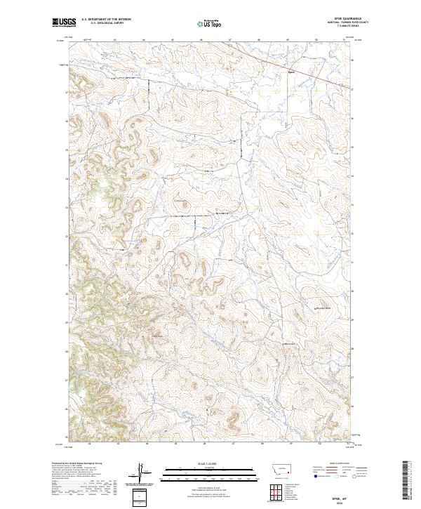
2024 Map of Epsie
USGS Topo · Published 2024About this map
Epsie serves as a lone focal point in this high plains landscape, situated near the northern edge of the survey where Mizpah Creek and Wiser Creek intersect. The terrain is defined by a dense network of seasonal drainages and prominent landforms, including the distinct elevations of Mc Allister Butte and Rattlesnake Butte. To the west, the landscape rises toward Castle Rock, overlooking the headwaters of Serviceberry Creek. This area of Powder River County remains largely open ranch land, traced by utilitarian routes like Burley Rd and Rice Rd. The map reveals a complex hydrographic system where North Fork Rock Springs Creek and Sanders Creek carve through the southern sections, illustrating the natural water management of the Montana backcountry.
Find a feature on this map
22 named features on this map. Tap any name to fly to it.
Don’t see what you’re looking for? This feature index may not catch every label — zoom into the map to look around manually.
Map Details
Editions of this 2024 Epsie Map
This is the sole edition of this map. No revisions or reprints were ever made.
Other maps of this area

1954 · Ekalaka
USGS Topo · 1:250,000

1956 · Ekalaka
USGS Topo · 1:250,000

1958 · Ekalaka
USGS Topo · 1:250,000

1965 · Ekalaka
USGS Topo · 1:250,000

1966 · Sonnette
USGS Topo · 1:24,000

1966 · Hodsdon Flats
USGS Topo · 1:24,000

1966 · Samuelson Ranch
USGS Topo · 1:24,000

1973 · Olive
USGS Topo · 1:24,000

1973 · Lonesome Peak
USGS Topo · 1:24,000
1973 · Yarger Butte
USGS Topo · 1:24,000