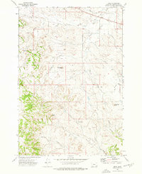
1973 Map of Epsie
USGS Topo · Published 1976About this map
The high-plains landscape of Powder River County reveals a network of seasonal watercourses and remote ranching settlements in the early 1970s. The small settlement of Epsie sits near the northern boundary, while Sanders and Flowing Wells mark points of activity further south. This region is defined by its drainage basins, where Mizpah Creek and its many tributaries, such as Two Tree Creek and Wiser Creek, carve through the terrain. The map captures the infrastructure of the era through several scattered wells and a notable Drill Hole in the eastern section.
Find a feature on this map
20 named features on this map. Tap any name to fly to it.
Don’t see what you’re looking for? This feature index may not catch every label — zoom into the map to look around manually.
Map Details
Editions of this 1973 Epsie Map
This is the sole edition of this map. No revisions or reprints were ever made.
Other maps of this area

1954 · Ekalaka
USGS Topo · 1:250,000

1956 · Ekalaka
USGS Topo · 1:250,000

1958 · Ekalaka
USGS Topo · 1:250,000

1965 · Ekalaka
USGS Topo · 1:250,000

1966 · Sonnette
USGS Topo · 1:24,000

1966 · Hodsdon Flats
USGS Topo · 1:24,000

1966 · Samuelson Ranch
USGS Topo · 1:24,000

1973 · Olive
USGS Topo · 1:24,000

1973 · Lonesome Peak
USGS Topo · 1:24,000
1973 · Yarger Butte
USGS Topo · 1:24,000