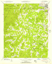
1941 Map of Epworth
USGS Topo · Published 1957About this map
Epworth and the industrial hub of Copperhill anchor this 1941 survey, which illustrates the complex borderlands where the Tennessee Georgia line intersects with the copper-rich basins of the Southern Blue Ridge. The terrain is a dense network of ridges such as Wolf Ridge and Turkeypen Ridge, punctuated by family-named hollows and gaps that dictated early settlement patterns. Industry and agriculture are closely linked, shown by the proximity of the Louisville and Nashville railroad to local processing sites like Patterson Mill and Galloway Mill.
Find a feature on this map
79 named features on this map. Tap any name to fly to it.
Don’t see what you’re looking for? This feature index may not catch every label — zoom into the map to look around manually.
Map Details
Editions of this 1941 Epworth Map
3 editions found
Other maps of this area

1886 · Dalton
USGS Topo · 1:125,000

1886 · Cleveland
USGS Topo · 1:125,000

1888 · Ellijay
USGS Topo · 1:125,000

1892 · Cleveland
USGS Topo · 1:125,000

1892 · Ellijay
USGS Topo · 1:125,000

1892 · Dalton
USGS Topo · 1:125,000

1893 · Murphy
USGS Topo · 1:125,000

1895 · Cleveland
USGS Topo · 1:125,000

1897 · Dalton
USGS Topo · 1:125,000

1898 · Ellijay
USGS Topo · 1:125,000