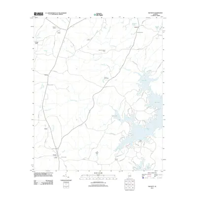
2011 Map of Equality
USGS Topo · Published 2011About this map
Oakachoy Covered Bridge stands as a notable landmark where Oakachoy Creek winds through the central terrain of Coosa County. In the south, the settlement of Equality serves as a local hub, anchored by the Equality Post Office and nearby Bethel Cemetery. The landscape is characterized by a high density of small family and community burial grounds, including the Peace and Goodwill Cemetery and Shiloh Cemetery, reflecting the long-established rural social fabric of the area. Toward the eastern edge, the topography shifts toward the aquatic recreation and residential developments surrounding Martin Lake, where Parker Creek Marina and Tates Fish Camp mark the transition from traditional farming and timberland to a lake-centered economy. Water management is evident through several small impoundments such as the Ewell C Forbes Dam and J M Granger Dam, which regulate the flow of creeks like Rocky Ford Creek and Chapman Creek.
Find a feature on this map
70 named features on this map. Tap any name to fly to it.
Don’t see what you’re looking for? This feature index may not catch every label — zoom into the map to look around manually.
Map Details
Editions of this 2011 Equality Map
This is the sole edition of this map. No revisions or reprints were ever made.
Other maps of this area

1901 · Wetumpka
USGS Topo · 1:125,000

1901 · Wetumpka
USGS Topo · 1:62,500

1903 · Wetumpka
USGS Topo · 1:125,000

1906 · Dadeville
USGS Topo · 1:125,000

1953 · Montgomery
USGS Topo · 1:250,000

1955 · Phenix City
USGS Topo · 1:250,000

1956 · Montgomery
USGS Topo · 1:250,000

1957 · Phenix City
USGS Topo · 1:250,000

1957 · Montgomery
USGS Topo · 1:250,000

1958 · Phenix City
USGS Topo · 1:250,000