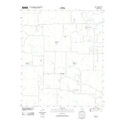
2010 Map of Era SE
USGS Topo · Published 2010About this map
Plainview serves as the central hub of this North Texas landscape, where the rural road network converges near the headwaters of the regional creek system. The terrain is defined by the drainage of North Hickory Creek and South Hickory Creek, which wind across the quadrangle alongside numerous flood control structures, including Soil Conservation Service Site 41 Dam and Soil Conservation Service Site 2 Dam. This era of the early 21st century shows a distinct pattern of small-scale aviation with three private facilities—Glass Airport, Haire Airport, and Bird Dog Field—scattered across the farm-to-market landscape. The map details a transition from traditional agriculture toward rural residential development, evidenced by the dense grid of family-named roads like Atcheson Rd, Donald Rd, and Mitchell Rd.
Find a feature on this map
45 named features on this map. Tap any name to fly to it.
Don’t see what you’re looking for? This feature index may not catch every label — zoom into the map to look around manually.
Map Details
Editions of this 2010 Era SE Map
This is the sole edition of this map. No revisions or reprints were ever made.
Other maps of this area

1954 · Sherman
USGS Topo · 1:250,000

1958 · Sherman
USGS Topo · 1:250,000

1959 · Ponder
USGS Topo · 1:24,000

1960 · Sanger
USGS Topo · 1:24,000

1960 · Bluett
USGS Topo · 1:24,000
1960 · Denton West
USGS Topo · 1:24,000

1961 · Era
USGS Topo · 1:24,000

1961 · Slidell
USGS Topo · 1:24,000
1961 · Era SE
USGS Topo · 1:24,000

1961 · Valley View
USGS Topo · 1:24,000