
1961 Map of Valley View
USGS Topo · Published 1963About this map
Valley View serves as the primary hub of this North Texas landscape, situated along the Gulf Colorado and Santa Fe railroad line. The map captures the area in the early 1960s, a period when the rural character of northern Cooke County and the border of Denton County was defined by its extensive drainage networks and small-scale industry. The terrain is deeply etched by numerous waterways including Spring Creek, Pecan Creek, and Indian Creek, which suggest a landscape historically shaped by agricultural grazing and seasonal water flow.
Find a feature on this map
17 named features on this map. Tap any name to fly to it.
Don’t see what you’re looking for? This feature index may not catch every label — zoom into the map to look around manually.
Map Details
Editions of this 1961 Valley View Map
2 editions found
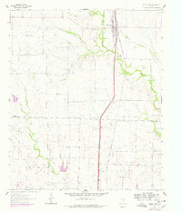
Other maps of this area

1902 · Gainesville
USGS Topo · 1:125,000

1943 · Gainesville
USGS Topo · 1:125,000

1954 · Sherman
USGS Topo · 1:250,000

1958 · Sherman
USGS Topo · 1:250,000

1960 · Sanger
USGS Topo · 1:24,000

1960 · Green Valley
USGS Topo · 1:24,000

1960 · Gainesville South
USGS Topo · 1:24,000

1960 · Woodbine
USGS Topo · 1:24,000

1961 · Era
USGS Topo · 1:24,000
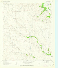
1961 · Era SE
USGS Topo · 1:24,000