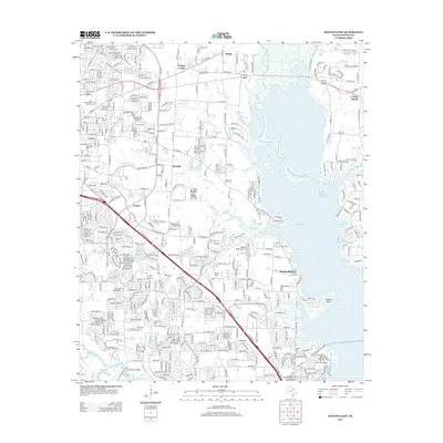
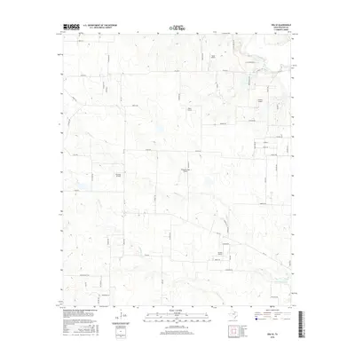
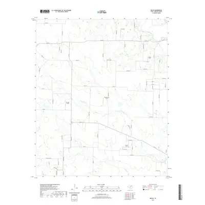
1961 Map of Era SE
USGS Topo · Published 1978About this map
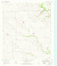
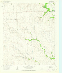
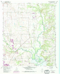
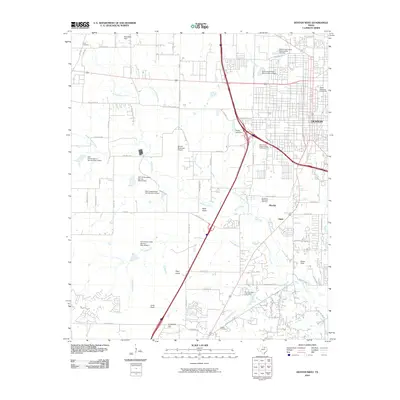
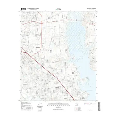
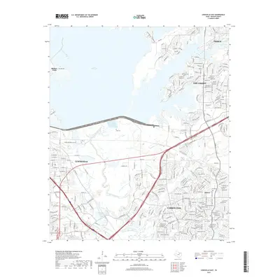
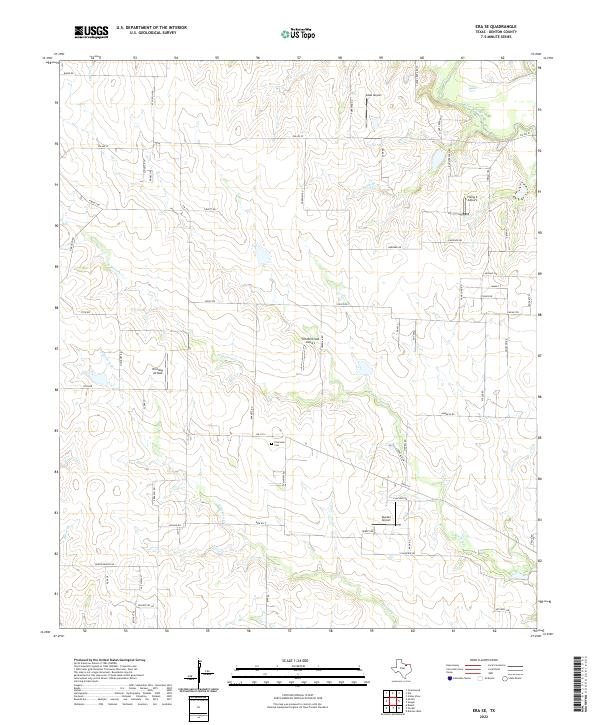
Plainview sits as the central point of interest in this North Texas landscape, where the rural character of Denton County is defined by a network of seasonal watercourses. The map traces the winding paths of North Hickory Creek and South Hickory Creek as they meander toward the east, while Clear Creek cuts through the northeastern corner. This 1961 survey, which includes updates from 1976, illustrates a transition in land use as traditional ranching and farming infrastructure is joined by energy development. The presence of the Bolivar Oil Field and scattered Oil Wells in the northeast indicates the subsurface economic drivers of the era, while a small Landing Strip and a Water Tank denote the essential utility and private transportation needs of this sparsely populated cattle country.
Find a feature on this map
17 named features on this map. Tap any name to fly to it.
Don’t see what you’re looking for? This feature index may not catch every label — zoom into the map to look around manually.
Map Details
Editions of this 1961 Era SE Map
2 editions found
Historical Maps of Plainview Through Time
37 maps found

1925 Mc Kinney 3-c
Denton County, TX
1960 Denton East
Denton County, TX
1960 Denton West
Denton County, TX
1960 Green Valley
Denton County, TX
1960 Lewisville East
Denton County, TX
1960 Lewisville West
Denton County, TX
1961 Era SE
Denton County, TX
2010 Denton East
Denton County, TX
2010 Denton West
Denton County, TX
2010 Era SE
Denton County, TX
2010 Green Valley
Denton County, TX

2010 Lewisville East
Denton County, TX
2010 Lewisville West
Denton County, TX
2013 Denton East
Denton County, TX
2013 Denton West
Denton County, TX
2013 Era SE
Denton County, TX
2013 Green Valley
Denton County, TX
2013 Lewisville East
Denton County, TX
2013 Lewisville West
Denton County, TX
2016 Denton East
Denton County, TX
2016 Denton West
Denton County, TX
2016 Era SE
Denton County, TX
2016 Green Valley
Denton County, TX
2016 Lewisville East
Denton County, TX
2016 Lewisville West
Denton County, TX
2019 Denton East
Denton County, TX
2019 Denton West
Denton County, TX
2019 Era SE
Denton County, TX
2019 Green Valley
Denton County, TX
2019 Lewisville East
Denton County, TX
2019 Lewisville West
Denton County, TX
2022 Denton East
Denton County, TX
2022 Denton West
Denton County, TX
2022 Era SE
Denton County, TX
2022 Green Valley
Denton County, TX
2022 Lewisville East
Denton County, TX
2022 Lewisville West
Denton County, TX