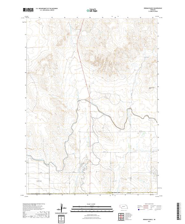
2021 Map of Erdman Ranch
USGS Topo · Published 2021About this map
Erdman Ranch and the fertile lowlands of Dutch Flats anchor this High Plains landscape at the border of Sioux and Scotts Bluff counties. The 2021 survey illustrates a region defined by an intricate irrigation system, essential for sustaining agriculture in this arid environment. The massive Interstate Canal winds across the southern half of the quadrangle, feeding a network of smaller channels like Lateral 21 Main and Lateral Number 18. Natural drainage is provided by Spottedtail Cr and Dry Spottedtail Cr, which meander through the prairie toward the North Platte River valley just south of this sheet. Rising above the irrigated fields, Rattlesnake Hill stands as a prominent landmark in the east, overlooking a grid of rural section roads including Cook Rd and S 13 Rd.
Find a feature on this map
28 named features on this map. Tap any name to fly to it.
Don’t see what you’re looking for? This feature index may not catch every label — zoom into the map to look around manually.
Map Details
Editions of this 2021 Erdman Ranch Map
This is the sole edition of this map. No revisions or reprints were ever made.
Other maps of this area

1898 · Scotts Bluff
USGS Topo · 1:125,000

1899 · Whistle Creek
USGS Topo · 1:125,000

1954 · Scottsbluff
USGS Topo · 1:250,000

1955 · Alliance
USGS Topo · 1:250,000

1957 · Alliance
USGS Topo · 1:250,000

1958 · Alliance
USGS Topo · 1:250,000

1958 · Scottsbluff
USGS Topo · 1:250,000

1963 · Chalk Buttes
USGS Topo · 1:24,000

1963 · Mitchell
USGS Topo · 1:24,000

1963 · Scottsbluff North
USGS Topo · 1:24,000