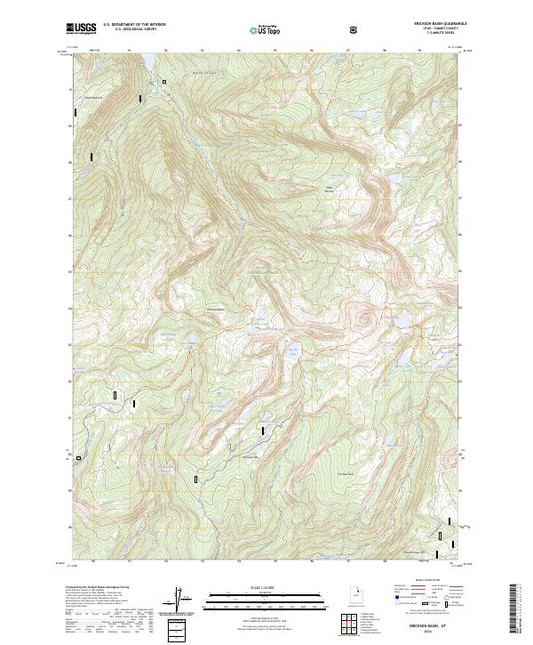
2023 Map of Erickson Basin
USGS Topo · Published 2023About this map
Wasatch National Forest dominates this high-altitude landscape in Summit County, where a dense concentration of glacial lakes and reservoirs defines the geography. At the heart of the area lies Erickson Basin, surrounded by a network of named waters including North Erickson Lake, South Erickson Lake, and the larger Big Elk Lake. The presence of Weir Reservoir and Pot Reservoir indicates the historical and ongoing importance of water management in this alpine environment. Transportation through this remote terrain is limited to primitive routes such as the Smith-Morehouse Trl and Upper Setting Rd, which provide access to uniquely named landmarks like Hells Kitchen and The Deli Dell. This 2023 survey documents a wilderness character preserved within the national forest system, where drainage systems like Smith and Morehouse Creek flow through deep cuts like Box Canyon.
Find a feature on this map
55 named features on this map. Tap any name to fly to it.
Don’t see what you’re looking for? This feature index may not catch every label — zoom into the map to look around manually.
Map Details
Editions of this 2023 Erickson Basin Map
This is the sole edition of this map. No revisions or reprints were ever made.
Other maps of this area

1885 · Salt Lake
USGS Topo · 1:250,000

1885 · Uinta
USGS Topo · 1:250,000

1900 · Coalville
USGS Topo · 1:125,000

1901 · Hayden Peak
USGS Topo · 1:125,000

1903 · Hayden Peak
USGS Topo · 1:125,000

1903 · Coalville
USGS Topo · 1:125,000

1954 · Salt Lake City
USGS Topo · 1:250,000

1958 · Salt Lake City
USGS Topo · 1:250,000

1960 · Salt Lake City
USGS Topo · 1:250,000
1972 · Iron Mine Mountain
USGS Topo · 1:24,000