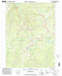
1998 Map of Erickson Basin
USGS Topo · Published 2001About this map
Ledgefork Guard Sta sits at the northern edge of this high-altitude landscape, marking a vital point of oversight for the surrounding Wasatch National Forest. The 1998 revision of the topography shows a complex drainage system where Smith and Morehouse Creek flows toward its namesake Smith and Morehouse Reservoir. The map reveals a dense network of alpine water bodies including North Erickson Lake, South Erickson Lake, and the uniquely shaped Hourglass Lake situated on Norway Flat.
Find a feature on this map
43 named features on this map. Tap any name to fly to it.
Don’t see what you’re looking for? This feature index may not catch every label — zoom into the map to look around manually.
Map Details
Editions of this 1998 Erickson Basin Map
This is the sole edition of this map. No revisions or reprints were ever made.
Other maps of this area

1885 · Salt Lake
USGS Topo · 1:250,000

1885 · Uinta
USGS Topo · 1:250,000

1900 · Coalville
USGS Topo · 1:125,000

1901 · Hayden Peak
USGS Topo · 1:125,000

1903 · Hayden Peak
USGS Topo · 1:125,000

1903 · Coalville
USGS Topo · 1:125,000

1954 · Salt Lake City
USGS Topo · 1:250,000

1958 · Salt Lake City
USGS Topo · 1:250,000

1960 · Salt Lake City
USGS Topo · 1:250,000
1972 · Iron Mine Mountain
USGS Topo · 1:24,000