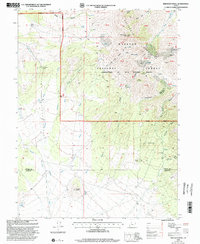
1998 Map of Erickson Knoll
USGS Topo · Published 2002About this map
The Sheeprock Mountains dominate this high-desert landscape in the Tooele and Juab borderlands. The terrain is defined by complex drainage systems like Erickson Creek and Elderberry Wash, which carved the rugged approaches to landmarks such as Erickson Pass and Bennion Peak. A history of remote ranching and hard-rock exploration is evident across the quadrangle, with Wright Ranch and Ekker Ranch marking the lowlands while prospectors pushed into the higher elevations. Mining activity was particularly concentrated in the east, where several notable operations including the Utah Mine, Flying Dutchman Mine, and Copper Jack Mine are located. Much of the area falls within the Spanish Fork Ranger District, providing a snapshot of public land use and resource extraction in the Great Basin at the close of the twentieth century.
Find a feature on this map
59 named features on this map. Tap any name to fly to it.
Don’t see what you’re looking for? This feature index may not catch every label — zoom into the map to look around manually.
Map Details
Editions of this 1998 Erickson Knoll Map
This is the sole edition of this map. No revisions or reprints were ever made.
Other maps of this area

1885 · Sevier Desert
USGS Topo · 1:250,000

1885 · Tooele Valley
USGS Topo · 1:250,000

1953 · Tooele
USGS Topo · 1:250,000

1953 · Delta
USGS Topo · 1:250,000

1955 · Indian Peaks
USGS Topo · 1:24,000

1955 · Indian Springs
USGS Topo · 1:24,000

1955 · Tooele
USGS Topo · 1:250,000

1958 · Delta
USGS Topo · 1:250,000

1962 · Delta
USGS Topo · 1:250,000

1963 · Dutch Peak
USGS Topo · 1:24,000