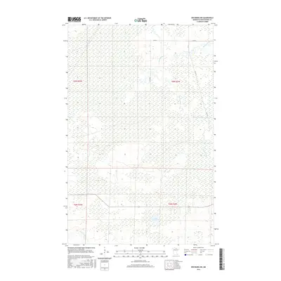
2016 Map of Ericsburg NW
USGS Topo · Published 2016About this map
Rat Root River meanders across the northeastern corner of this landscape, a remote stretch of Koochiching County dominated by extensive wetlands and low-lying terrain. The hydrography of the region is defined by the slow drainage of the Beaver Brook and the quiet waters of Moose Lake in the southern sections. This 2016 survey illustrates the sparse infrastructure characteristic of the Minnesota borderlands, where human presence is marked primarily by a few essential corridors like Co Rd 97 and Galvin Ln. The map's layout highlights the Public Land Survey System grid, tracing the boundaries of Townships 68 and 69 North, which organize this water-heavy wilderness. For those studying the environmental history of the far north, the map provides a precise record of the shoreline and marsh extents before recent climatic shifts.
Find a feature on this map
10 named features on this map. Tap any name to fly to it.
Don’t see what you’re looking for? This feature index may not catch every label — zoom into the map to look around manually.
Map Details
Editions of this 2016 Ericsburg NW Map
This is the sole edition of this map. No revisions or reprints were ever made.
Other maps of this area
1919 · Pelland
USGS Topo · 1:62,500
1919 · Happy Land
USGS Topo · 1:62,500
1919 · International Falls
USGS Topo · 1:62,500

1954 · International Falls
USGS Topo · 1:250,000

1957 · International Falls
USGS Topo · 1:250,000

1958 · International Falls
USGS Topo · 1:250,000
1963 · Ranier
USGS Topo · 1:24,000
1969 · Ericsburg NW
USGS Topo · 1:24,000
1969 · Ericsburg
USGS Topo · 1:24,000
1969 · Ericsburg SE
USGS Topo · 1:24,000