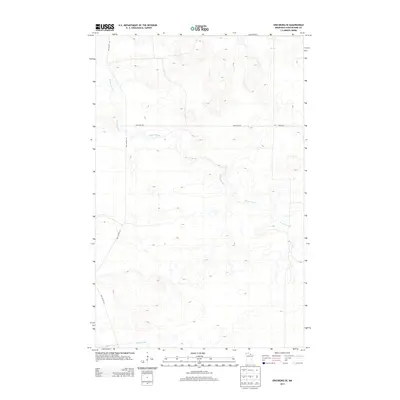
2013 Map of Ericsburg SE
USGS Topo · Published 2013About this map
Beaver Brook meanders across this northern landscape, defining the hydrology of a region dominated by low-lying wetlands and subtle glacial topography. In the southern reach of the quadrangle, Ester Brook begins its drainage, illustrating the intricate water network characteristic of Koochiching County. This 2013 survey reflects a sparse human footprint, where connectivity is maintained through isolated thoroughfares such as Galleger Rd and Boyum Rd. The road network, including Old Galvin Ln, suggests a history of timber access or rural homesteading. For researchers, the map provides a contemporary record of the shifting watercourses and the established rural infrastructure in this quiet corner of northern Minnesota.
Find a feature on this map
5 named features on this map. Tap any name to fly to it.
Don’t see what you’re looking for? This feature index may not catch every label — zoom into the map to look around manually.
Map Details
Editions of this 2013 Ericsburg SE Map
This is the sole edition of this map. No revisions or reprints were ever made.
Other maps of this area

1954 · International Falls
USGS Topo · 1:250,000

1957 · International Falls
USGS Topo · 1:250,000

1958 · International Falls
USGS Topo · 1:250,000
1969 · Ericsburg NW
USGS Topo · 1:24,000
1969 · Ericsburg
USGS Topo · 1:24,000
1969 · Ericsburg SE
USGS Topo · 1:24,000
1969 · Ray
USGS Topo · 1:24,000
1969 · Ray SW
USGS Topo · 1:24,000
1969 · Ericsburg SW
USGS Topo · 1:24,000
1970 · Nett Lake River East
USGS Topo · 1:24,000