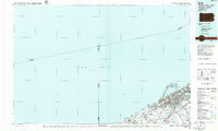
1985 Map of Erie
USGS Topo · Published 1986About this map
The industrial and maritime hub of Erie dominates this mid-1980s planimetric survey, which illustrates the city's complex relationship with the Great Lakes shoreline. The distinctive peninsula of Presque Isle and Presque Isle State Park forms the protective barrier for Presque Isle Bay, while the urban core expands eastward through Lawrence Park and Wesleyville. The map captures the transportation infrastructure critical to the region's economy, from the Erie International Airport to the heavy rail corridors of Conrail and the Norfolk and Western lines that parallel the coast.
Find a feature on this map
47 named features on this map. Tap any name to fly to it.
Don’t see what you’re looking for? This feature index may not catch every label — zoom into the map to look around manually.
Map Details
Editions of this 1985 Erie Map
This is the sole edition of this map. No revisions or reprints were ever made.
Other maps of this area

1899 · Erie
USGS Topo · 1:62,500

1900 · Girard
USGS Topo · 1:62,500

1900 · Erie
USGS Topo · 1:62,500

1900 · Fairview
USGS Topo · 1:62,500

1905 · Ashtabula
USGS Topo · 1:62,500

1905 · Perry
USGS Topo · 1:62,500

1906 · Conneaut
USGS Topo · 1:62,500

1913 · North East
USGS Topo · 1:62,500

1915 · North East
USGS Topo · 1:62,500

1923 · Cambridge Springs
USGS Topo · 1:62,500