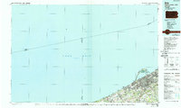
1988 Map of Erie
USGS Topo · Published 1989About this map
Erie and the industrial coastline of Northwest Pennsylvania are captured here during a period of transition in the late 1980s. The map illustrates the complex interaction between the urban centers of Millcreek and the specialized geography of Presque Isle, which curves around Presque Isle Bay to protect the city's harbor. Beyond the city limits, the landscape shifts into a series of smaller established communities such as Fairview, Girard, and McKean, linked by a network of creeks like Elk Creek and Walnut Creek.
Find a feature on this map
46 named features on this map. Tap any name to fly to it.
Don’t see what you’re looking for? This feature index may not catch every label — zoom into the map to look around manually.
Map Details
Editions of this 1988 Erie Map
This is the sole edition of this map. No revisions or reprints were ever made.
Other maps of this area

1899 · Erie
USGS Topo · 1:62,500

1900 · Girard
USGS Topo · 1:62,500

1900 · Erie
USGS Topo · 1:62,500

1900 · Fairview
USGS Topo · 1:62,500

1905 · Ashtabula
USGS Topo · 1:62,500

1905 · Perry
USGS Topo · 1:62,500

1906 · Conneaut
USGS Topo · 1:62,500

1913 · North East
USGS Topo · 1:62,500

1915 · North East
USGS Topo · 1:62,500

1923 · Cambridge Springs
USGS Topo · 1:62,500