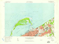
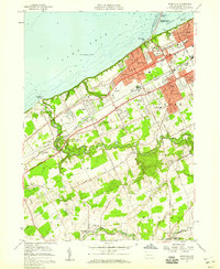
1957 Map of Erie North
USGS Topo · Published 1959About this map
Presque Isle State Park dominates the northern reaches of this map, its arching peninsula shielding Presque Isle Bay and providing a natural harbor for the city of Erie. The landscape is a study in the juxtaposition of preserved nature and urban industry during the late 1950s. While the peninsula is dotted with isolated water bodies like Big Pond and Cranberry Pond, the mainland is densely packed with parochial and public institutions, including Gannon College, St Marks Seminary, and the State Soldiers and Sailors Home. To the east, the industrial character of the lakefront is evident in Lawrence Park and Wesleyville, where the infrastructure of the New York Central and St Louis RR and Pennsylvania railroads carved paths through the developing residential and commercial blocks.
Find a feature on this map
69 named features on this map. Tap any name to fly to it.
Don’t see what you’re looking for? This feature index may not catch every label — zoom into the map to look around manually.
Map Details
Editions of this 1957 Erie North Map
4 editions found
Other maps of this area

1899 · Erie
USGS Topo · 1:62,500

1900 · Erie
USGS Topo · 1:62,500

1913 · North East
USGS Topo · 1:62,500

1915 · North East
USGS Topo · 1:62,500

1943 · North East
USGS Topo · 1:62,500

1950 · Erie
USGS Topo · 1:250,000

1957 · Erie South
USGS Topo · 1:24,000
1957 · Swanville
USGS Topo · 1:24,000

1959 · Erie
USGS Topo · 1:250,000

1960 · Buffalo
USGS Topo · 1:250,000
Featured Places
- Erie, PA
- Harborcreek Township, PA
- Lawrence Park Township, PA
- Wesleyville, PA
- Fairfield, Harborcreek Township