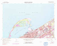
1957 Map of Erie North
USGS Topo · Published 1991About this map
Presque Isle State Park arcs across the top of this topographic study, forming a natural breakwater for the harbor at Erie. The map documents the mid-century shoreline and the intricate interior hydrology of the peninsula, including Big Pond, Long Pond, and Misery Bay. On the mainland, the dense urban fabric of Erie and Wesleyville is defined by a heavy concentration of religious and educational institutions, such as St Benedicts Academy and Gannon College, alongside the industrial corridor of the Penn Central and Norfolk and Western railroads.
Find a feature on this map
57 named features on this map. Tap any name to fly to it.
Don’t see what you’re looking for? This feature index may not catch every label — zoom into the map to look around manually.
Map Details
Editions of this 1957 Erie North Map
4 editions found
Other maps of this area

1899 · Erie
USGS Topo · 1:62,500

1900 · Erie
USGS Topo · 1:62,500

1913 · North East
USGS Topo · 1:62,500

1915 · North East
USGS Topo · 1:62,500

1943 · North East
USGS Topo · 1:62,500

1950 · Erie
USGS Topo · 1:250,000

1957 · Erie South
USGS Topo · 1:24,000
1957 · Swanville
USGS Topo · 1:24,000
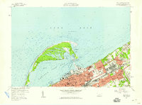
1957 · Erie North
USGS Topo · 1:24,000

1959 · Erie
USGS Topo · 1:250,000
Featured Places
- Erie, PA
- Harborcreek Township, PA
- Lawrence Park Township, PA
- Wesleyville, PA
- Fairfield, Harborcreek Township