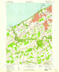
1957 Map of Swanville
USGS Topo · Published 1959About this map
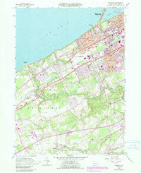
Presque Isle State Park and the western edge of Erie anchor this coastal landscape during the late 1950s, showing a transition from dense urban development to suburban expansion and rural stream valleys. The shoreline is characterized by recreational and institutional sites, from the grounds of Waldameer Park and the Villa Maria Academy to the seasonal destination of Manchester Beach. Further inland, the map captures the burgeoning suburban identity of Lakewood, Eaglehurst, and West Millcreek, while the southern reaches near Middleboro maintain a more agrarian character defined by the winding course of Walnut Creek and Elk Creek.
Find a feature on this map
46 named features on this map. Tap any name to fly to it.
Don’t see what you’re looking for? This feature index may not catch every label — zoom into the map to look around manually.
Map Details
Editions of this 1957 Swanville Map
5 editions found
Other maps of this area

1899 · Erie
USGS Topo · 1:62,500

1900 · Girard
USGS Topo · 1:62,500

1900 · Erie
USGS Topo · 1:62,500

1900 · Fairview
USGS Topo · 1:62,500

1923 · Cambridge Springs
USGS Topo · 1:62,500

1925 · Cambridge Springs
USGS Topo · 1:62,500

1943 · Cambridge Springs
USGS Topo · 1:62,500

1950 · Cleveland
USGS Topo · 1:250,000

1950 · Erie
USGS Topo · 1:250,000

1956 · Cleveland
USGS Topo · 1:250,000