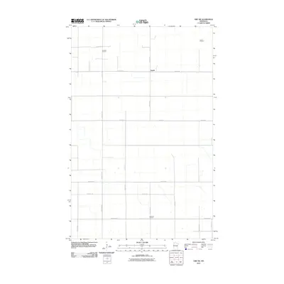
2010 Map of Erie NW
USGS Topo · Published 2010About this map
Espelie serves as the primary landmark in this rural Marshall County landscape, situated amidst a highly structured grid of section-line roads. This portion of northern Minnesota is characterized by its agricultural organization, where long-established burial grounds like Espelie Cemetery, Jerusalem Cemetery, and Rosindhall Cemetery remain as central points for local family history. The layout of the region is defined by a rigorous network of county highways and local thoroughfares, including County Hwy-9 and County Hwy-63, which facilitate transit across the level terrain. This 2010 survey reflects a period of modern rural stability, documenting the precise intersections and property boundaries that have shaped the township for generations.
Find a feature on this map
20 named features on this map. Tap any name to fly to it.
Don’t see what you’re looking for? This feature index may not catch every label — zoom into the map to look around manually.
Map Details
Editions of this 2010 Erie NW Map
This is the sole edition of this map. No revisions or reprints were ever made.
Other maps of this area

1918 · Rollis
USGS Topo · 1:62,500

1919 · Liner
USGS Topo · 1:62,500

1943 · Rollis
USGS Topo · 1:62,500

1954 · Roseau
USGS Topo · 1:250,000

1957 · Roseau
USGS Topo · 1:250,000

1958 · Roseau
USGS Topo · 1:250,000

1962 · Gatzke SE
USGS Topo · 1:24,000

1972 · Erie
USGS Topo · 1:24,000
1972 · Goodridge
USGS Topo · 1:24,000
1972 · Good Lake
USGS Topo · 1:24,000