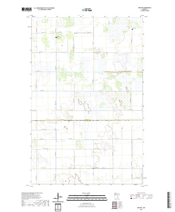
2022 Map of Erie NW
USGS Topo · Published 2022About this map
The Marshall County and Pennington County border divides this landscape of Northern Minnesota, where low-lying wetlands and drainage patterns dominate the terrain. The area is defined by a sparse grid of rural roads such as Co Hwy 53 and Co Hwy 64, supporting a remote agricultural and conservation-focused environment. In the northern reaches, the Consolidated Conservation Trails Trl suggests a dedicated use of the land for wildlife management and state-protected resources within the Red River Valley region.
Find a feature on this map
36 named features on this map. Tap any name to fly to it.
Don’t see what you’re looking for? This feature index may not catch every label — zoom into the map to look around manually.
Map Details
Editions of this 2022 Erie NW Map
This is the sole edition of this map. No revisions or reprints were ever made.
Other maps of this area

1918 · Rollis
USGS Topo · 1:62,500

1919 · Liner
USGS Topo · 1:62,500

1943 · Rollis
USGS Topo · 1:62,500

1954 · Roseau
USGS Topo · 1:250,000

1957 · Roseau
USGS Topo · 1:250,000

1958 · Roseau
USGS Topo · 1:250,000

1962 · Gatzke SE
USGS Topo · 1:24,000

1972 · Erie
USGS Topo · 1:24,000
1972 · Goodridge
USGS Topo · 1:24,000
1972 · Good Lake
USGS Topo · 1:24,000