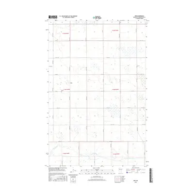
2016 Map of Erie
USGS Topo · Published 2016About this map
Red Lake River meanders across the southern reaches of this Pennington County landscape, providing a natural contrast to the rigid section lines of the Public Land Survey System. The small settlement of Erie occupies a central position, serving as a focal point for a rural community connected by a network of gravel and paved routes such as Co Rd 6 and 350th Ave NE. The map reveals the placement of several local burial grounds, including Star Cem and Ekelund Cem, which are essential markers for genealogists and family historians researching this portion of northern Minnesota. The terrain is characterized by numerous small wetlands and drainage patterns that reflect the region's glacial history, influenced by the township boundaries of t153n r40w and t154n r39w.
Find a feature on this map
31 named features on this map. Tap any name to fly to it.
Don’t see what you’re looking for? This feature index may not catch every label — zoom into the map to look around manually.
Map Details
Editions of this 2016 Erie Map
This is the sole edition of this map. No revisions or reprints were ever made.
Other maps of this area

1919 · Grit
USGS Topo · 1:62,500

1919 · Winsor
USGS Topo · 1:62,500

1954 · Bemidji
USGS Topo · 1:250,000

1954 · Roseau
USGS Topo · 1:250,000

1957 · Roseau
USGS Topo · 1:250,000

1957 · Bemidji
USGS Topo · 1:250,000

1958 · Bemidji
USGS Topo · 1:250,000

1958 · Roseau
USGS Topo · 1:250,000
1971 · Roland
USGS Topo · 1:24,000

1972 · Erie
USGS Topo · 1:24,000