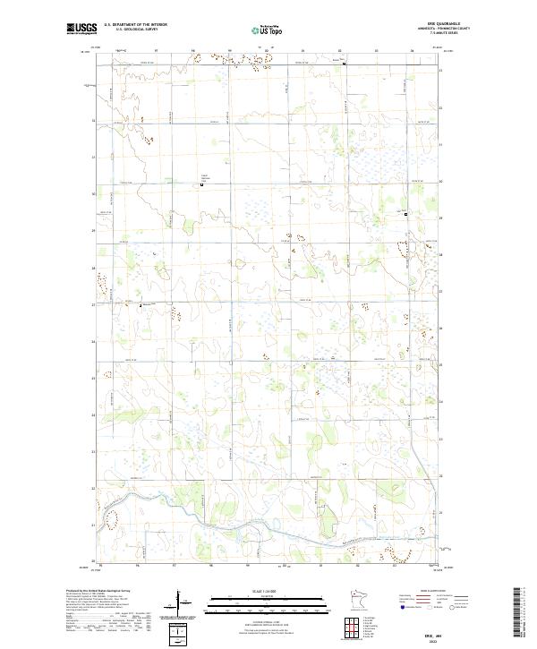
2022 Map of Erie
USGS Topo · Published 2022About this map
The Red Lake River meanders across the southern portion of this Pennington County landscape, defining the hydrological character of the region. The map reveals a strictly organized grid of agricultural and section lines, typical of this part of Minnesota. For genealogists and local historians, several community burial grounds serve as primary landmarks in this sparsely settled area. These include the Czech National Cem, located along 150th St NE, as well as Star Cem, Ekelund Cem, and Reiner Cem. The terrain is characterized by the Red Lake River Tri and a dense network of township and county roads, such as Co Rd 62 and Co Rd 6, which facilitate movement through the extensive wetlands and fields that dominate the township sections.
Find a feature on this map
25 named features on this map. Tap any name to fly to it.
Don’t see what you’re looking for? This feature index may not catch every label — zoom into the map to look around manually.
Map Details
Editions of this 2022 Erie Map
This is the sole edition of this map. No revisions or reprints were ever made.
Other maps of this area

1919 · Grit
USGS Topo · 1:62,500

1919 · Winsor
USGS Topo · 1:62,500

1954 · Bemidji
USGS Topo · 1:250,000

1954 · Roseau
USGS Topo · 1:250,000

1957 · Roseau
USGS Topo · 1:250,000

1957 · Bemidji
USGS Topo · 1:250,000

1958 · Bemidji
USGS Topo · 1:250,000

1958 · Roseau
USGS Topo · 1:250,000
1971 · Roland
USGS Topo · 1:24,000

1972 · Erie
USGS Topo · 1:24,000