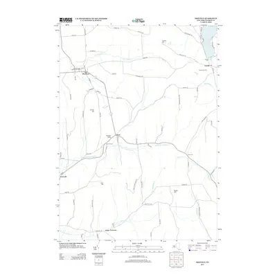
2013 Map of Erieville
USGS Topo · Published 2013About this map
New Woodstock and Erieville anchor this rural Madison County landscape, where the headwaters of several significant drainage systems diverge. The northern portion is defined by Tuscarora Lake and the winding course of E Br Limestone Cr, while the southern reaches follow the Middle Br Tioughnioga Cr and Otselic River. This area exhibits a pattern of upland farming and small crossroads hamlets, including Sheds and the historically evocative Quaker Settlement. Elevated landmarks such as Kinney Hill and Muller Hill overlook the narrow valleys where old routes like Old Route 13 and Erieville Rd connect isolated farmsteads like Shadowfax Farm. Genealogists will find value in the detailed plotting of local burials at Erieville Cem, Allard Cem, and the New Woodstock Baptist Church Cem.
Find a feature on this map
77 named features on this map. Tap any name to fly to it.
Don’t see what you’re looking for? This feature index may not catch every label — zoom into the map to look around manually.
Map Details
Editions of this 2013 Erieville Map
This is the sole edition of this map. No revisions or reprints were ever made.
Other maps of this area

1897 · Cazenovia
USGS Topo · 1:62,500

1899 · Cazenovia
USGS Topo · 1:62,500

1902 · Morrisville
USGS Topo · 1:62,500

1903 · Norwich
USGS Topo · 1:62,500

1904 · Pitcher
USGS Topo · 1:62,500

1942 · Oran
USGS Topo · 1:24,000
1943 · Oran
USGS Topo · 1:31,680

1943 · Otselic
USGS Topo · 1:24,000

1943 · De Ruyter
USGS Topo · 1:24,000
1943 · Cazenovia
USGS Topo · 1:24,000