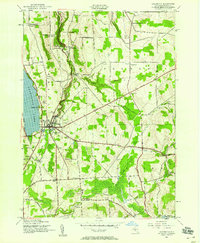
1943 Map of Cazenovia
USGS Topo · Published 1958About this map
Cazenovia Lake and the village of Cazenovia serve as the focal point for this mid-century survey of Madison County. The landscape reflects a deeply established rural network of small hamlets and crossroads, including Nelson, Fenner, and the uniquely named Hardscrabble. Transportation is dominated by the Cherry Valley Turnpike cutting across the terrain, alongside the Lehigh Valley railroad line. Local industry and natural landmarks are prominent, from the Stone Quarry at Stone Quarry Hill to the cascades of Chittenango Falls State Park.
Find a feature on this map
51 named features on this map. Tap any name to fly to it.
Don’t see what you’re looking for? This feature index may not catch every label — zoom into the map to look around manually.
Map Details
Editions of this 1943 Cazenovia Map
4 editions found
Other maps of this area

1895 · Chittenango
USGS Topo · 1:62,500

1895 · Oneida
USGS Topo · 1:62,500

1897 · Cazenovia
USGS Topo · 1:62,500

1898 · Oneida
USGS Topo · 1:62,500

1898 · Chittenango
USGS Topo · 1:62,500

1899 · Cazenovia
USGS Topo · 1:62,500

1902 · Chittenango
USGS Topo · 1:62,500

1902 · Morrisville
USGS Topo · 1:62,500

1902 · Oneida
USGS Topo · 1:62,500

1939 · Oneida
USGS Topo · 1:62,500