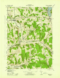
1944 Map of Erieville
USGS Topo · Published 1944About this map
New Woodstock and Erieville anchor this mid-century portrait of southern Madison County, where the dairy-rich uplands meet the headwaters of several major watersheds. The Lehigh Valley railroad cuts a diagonal path through the terrain, serving Delphi Station and the cluster of activity at Sheds. Near the southern border, the Quaker Settlement reflects the area's early religious history, situated among the steep ridges of Hunt Hill and Mutter Hill.
Find a feature on this map
34 named features on this map. Tap any name to fly to it.
Don’t see what you’re looking for? This feature index may not catch every label — zoom into the map to look around manually.
Map Details
Editions of this 1944 Erieville Map
This is the sole edition of this map. No revisions or reprints were ever made.
Other maps of this area

1897 · Cazenovia
USGS Topo · 1:62,500

1899 · Cazenovia
USGS Topo · 1:62,500

1902 · Morrisville
USGS Topo · 1:62,500

1903 · Norwich
USGS Topo · 1:62,500

1904 · Pitcher
USGS Topo · 1:62,500

1942 · Oran
USGS Topo · 1:24,000
1943 · Oran
USGS Topo · 1:31,680

1943 · Otselic
USGS Topo · 1:24,000

1943 · De Ruyter
USGS Topo · 1:24,000
1943 · Cazenovia
USGS Topo · 1:24,000