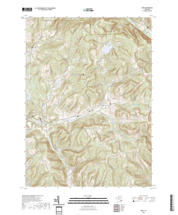
2023 Map of Erin
USGS Topo · Published 2023About this map
Newtown Creek and its various tributaries define the valley-and-ridge landscape of this Chemung County area, where small settlements like Erin and Breesport are centers of community life. The map is particularly notable for its dense concentration of burial sites, including the Old Baptist Cem, Scotchtown Cem, and Fairview Cem, which offer significant value for genealogists tracing local families. These cemeteries are often located on the lower slopes of the region's prominent heights, such as Langdon Hill and Laurel Hill.
Find a feature on this map
90 named features on this map. Tap any name to fly to it.
Don’t see what you’re looking for? This feature index may not catch every label — zoom into the map to look around manually.
Map Details
Editions of this 2023 Erin Map
This is the sole edition of this map. No revisions or reprints were ever made.
Other maps of this area

1893 · Ithaca
USGS Topo · 1:62,500

1895 · Ithaca
USGS Topo · 1:62,500

1895 · Elmira
USGS Topo · 1:62,500

1898 · Watkins Glen
USGS Topo · 1:62,500

1901 · Watkins
USGS Topo · 1:62,500

1902 · Waverly
USGS Topo · 1:62,500

1905 · Watkins Glen
USGS Topo · 1:125,000

1950 · Elmira
USGS Topo · 1:250,000

1950 · Alpine
USGS Topo · 1:24,000
1950 · West Danby
USGS Topo · 1:24,000