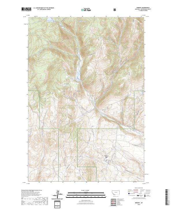
2024 Map of Ermont
USGS Topo · Published 2024About this map
Ermont Mill sits at the southern edge of the Pioneer Mountains, a landscape defined by sharp elevation changes and deep drainages. This high-altitude terrain in Beaverhead County is shaped by prominent ridges like Badger Ridge and landmarks such as Red Butte. Water sources are critical in this environment, represented here by Estler Lake, Kelley Reservoir, and numerous seasonal flows through Sawlog Gulch and Watson Gulch. The road network, including Ermont Rd and Badger Pass Rd, follows the natural contours of the gulches, tracing a path through the canyon floors and mountain passes. Named springs like Taylor Spring and Argenta Spring suggest the importance of reliable water for early mining and ranching efforts in this part of Montana.
Find a feature on this map
41 named features on this map. Tap any name to fly to it.
Don’t see what you’re looking for? This feature index may not catch every label — zoom into the map to look around manually.
Map Details
Editions of this 2024 Ermont Map
This is the sole edition of this map. No revisions or reprints were ever made.
Other maps of this area

1893 · Dillon
USGS Topo · 1:250,000

1952 · Twin Adams Mountain
USGS Topo · 1:24,000

1952 · Argenta
USGS Topo · 1:24,000

1952 · Bannack
USGS Topo · 1:24,000

1952 · Burns Mountain
USGS Topo · 1:24,000

1952 · Torrey Mountain
USGS Topo · 1:24,000

1952 · Ermont
USGS Topo · 1:24,000

1955 · Dillon
USGS Topo · 1:250,000

1957 · Dillon
USGS Topo · 1:250,000

1958 · Dillon
USGS Topo · 1:250,000