
1952 Map of Twin Adams Mountain
USGS Topo · Published 1954About this map
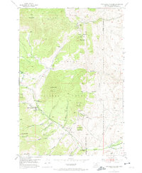
Beaverhead National Forest defines this high-elevation landscape in the early 1950s, where mining activity and water management intersect in the Pioneer Mountains. The survey identifies a clear transition in land use, showing an active Mine on the slopes of Twin Adams Mountain alongside numerous inactive sites like the Greenstone Mine and Indian Queen Mine. The network of steep drainages, including Farlin Gulch and Greenstone Gulch, feeds into the Birch Creek system, where the Birch Creek Ranger Station and a nearby Gaging Station monitor the flow. This era of resource extraction is further evidenced by a Lime Quarry, various Mine Shafts, and Mine Tunnels. Agricultural infrastructure is visible in the lower elevations through the Beaverhead Water Co Ditch, which redirects mountain runoff to the surrounding valley floor.
Find a feature on this map
37 named features on this map. Tap any name to fly to it.
Don’t see what you’re looking for? This feature index may not catch every label — zoom into the map to look around manually.
Map Details
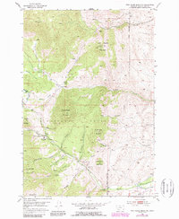
Editions of this 1952 Twin Adams Mountain Map
3 editions found
Other maps of this area

1893 · Dillon
USGS Topo · 1:250,000

1952 · Argenta
USGS Topo · 1:24,000

1952 · Torrey Mountain
USGS Topo · 1:24,000

1952 · Ermont
USGS Topo · 1:24,000

1955 · Dillon
USGS Topo · 1:250,000

1957 · Dillon
USGS Topo · 1:250,000

1958 · Dillon
USGS Topo · 1:250,000

1958 · Vipond Park
USGS Topo · 1:62,500

1960 · Glen
USGS Topo · 1:24,000

1961 · Earls Gulch
USGS Topo · 1:24,000