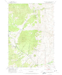
1952 Map of Twin Adams Mountain
USGS Topo · Published 1974About this map
Twin Adams Mountain and the surrounding high country of the Beaverhead National Forest reveal a landscape defined by mid-century extraction and federal land management. Evidence of the region's mining heritage is prominent along the slopes of Greenstone Mountain, where the Greenstone Mine and various Mine Shafts are located. Further south, near Canyon Gulch, the Indian Queen Mine and a Lime Quarry suggest a busy industrial pocket during the early 1950s.
Find a feature on this map
38 named features on this map. Tap any name to fly to it.
Don’t see what you’re looking for? This feature index may not catch every label — zoom into the map to look around manually.
Map Details
Editions of this 1952 Twin Adams Mountain Map
3 editions found
Other maps of this area

1893 · Dillon
USGS Topo · 1:250,000

1952 · Twin Adams Mountain
USGS Topo · 1:24,000

1952 · Argenta
USGS Topo · 1:24,000

1952 · Torrey Mountain
USGS Topo · 1:24,000

1952 · Ermont
USGS Topo · 1:24,000

1955 · Dillon
USGS Topo · 1:250,000

1957 · Dillon
USGS Topo · 1:250,000

1958 · Dillon
USGS Topo · 1:250,000

1958 · Vipond Park
USGS Topo · 1:62,500

1960 · Glen
USGS Topo · 1:24,000