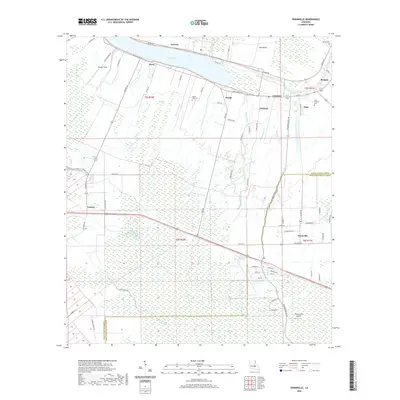
2020 Map of Erwinville
USGS Topo · Published 2020About this map
False River defines the northern reaches of this landscape, a former channel of the Mississippi that shaped the settlement patterns of Pointe Coupee Parish and West Baton Rouge Parish. The map illustrates a dense network of bayous, including Bayou Poydras, Bayou Sere, and Bayou Fusilier, which drain the low-lying agricultural lands surrounding communities like Lakeland, Rougon, and Erwinville. The long, narrow land divisions characteristic of French colonial heritage are visible in the road layout, extending from the riverfront toward the interior swamps.
Find a feature on this map
80 named features on this map. Tap any name to fly to it.
Don’t see what you’re looking for? This feature index may not catch every label — zoom into the map to look around manually.
Map Details
Editions of this 2020 Erwinville Map
This is the sole edition of this map. No revisions or reprints were ever made.
Other maps of this area

1906 · Bayou Sara
USGS Topo · 1:125,000

1935 · Osca Bayou
USGS Topo · 1:62,500

1939 · Fordoche
USGS Topo · 1:62,500

1940 · Grosse Tete
USGS Topo · 1:62,500

1953 · Lobdell
USGS Topo · 1:24,000

1953 · Maringouin
USGS Topo · 1:24,000

1953 · New Roads
USGS Topo · 1:24,000

1954 · Port Hudson
USGS Topo · 1:24,000

1954 · Walls
USGS Topo · 1:24,000

1954 · Fordoche
USGS Topo · 1:24,000