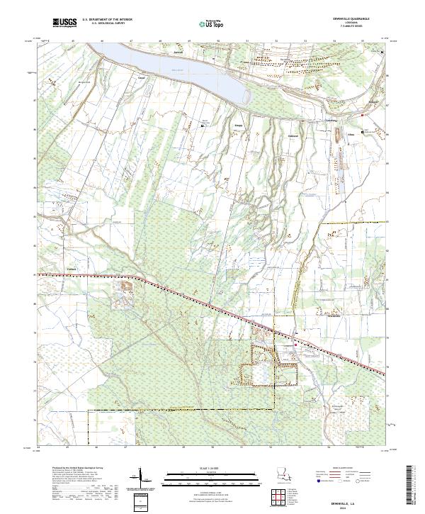
2024 Map of Erwinville
USGS Topo · Published 2024About this map
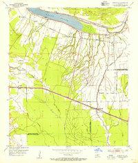
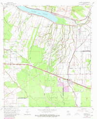
False River and The Chenal dominate the northern landscape of this region, where the historical settlement patterns of Pointe Coupee Parish and West Baton Rouge Parish meet. This 2024 survey illustrates a rural corridor defined by agriculture and aviation, notably featuring the Schexnayder Airport near the community of Erwinville. The drainage network, including Bayou Poydras and Bayou Fusilier, highlights the low-lying terrain of the lower Mississippi Valley, punctuated by expansive areas like Greeves Swamp.
Find a feature on this map
87 named features on this map. Tap any name to fly to it.
Don’t see what you’re looking for? This feature index may not catch every label — zoom into the map to look around manually.
Map Details
Editions of this 2024 Erwinville Map
This is the sole edition of this map. No revisions or reprints were ever made.
Historical Maps of Alma Through Time
3 maps found