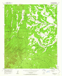
1954 Map of Escabosa
USGS Topo · Published 1963About this map
Escabosa and the surrounding high-elevation settlements sit at the intersection of complex land boundaries in the mid-1950s. This survey illustrates a landscape defined by historic land grants and government tracts, where the Chilili Grant, Isleta Tract, and Cibola National Forest meet. Small mountain communities such as Yrisarri, Tranquillo Pine, and Ponderosa Pine are connected by a network of unimproved roads and trails that navigate a series of deep canyons, including Lujan Canyon and David Canyon.
Find a feature on this map
33 named features on this map. Tap any name to fly to it.
Don’t see what you’re looking for? This feature index may not catch every label — zoom into the map to look around manually.
Map Details
Editions of this 1954 Escabosa Map
3 editions found
Other maps of this area

1892 · San Pedro
USGS Topo · 1:125,000

1917 · Estancia
USGS Topo · 1:125,000

1954 · Bosque Peak
USGS Topo · 1:24,000

1954 · Chilili
USGS Topo · 1:24,000

1954 · Mount Washington
USGS Topo · 1:24,000
1954 · Tijeras
USGS Topo · 1:24,000

1954 · Sedillo
USGS Topo · 1:24,000

1954 · Tajique
USGS Topo · 1:24,000

1954 · Escabosa
USGS Topo · 1:24,000

1954 · Edgewood
USGS Topo · 1:24,000