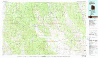
1980 Map of Escalante
USGS Topo · Published 1988About this map
Escalante and the nearby settlements of Henrieville and Boulder Town anchor this 1980 study of south-central Utah's high desert plateaus. The landscape is defined by massive structural features like the Straight Cliffs and the Kaiparowits Plateau, showing a region where geography dictates human movement. Water sources are scarce but critical, evidenced by the Wide Hollow Reservoir and the drainage network of the Escalante River carving through Death Hollow.
Find a feature on this map
65 named features on this map. Tap any name to fly to it.
Don’t see what you’re looking for? This feature index may not catch every label — zoom into the map to look around manually.
Map Details
Editions of this 1980 Escalante Map
3 editions found
Other maps of this area

1885 · San Rafael
USGS Topo · 1:250,000

1885 · Beaver
USGS Topo · 1:250,000

1885 · Fish Lake
USGS Topo · 1:250,000

1886 · Kanab
USGS Topo · 1:250,000

1886 · Escalante
USGS Topo · 1:250,000

1886 · Henry Mountains
USGS Topo · 1:250,000

1892 · Henry Mountains
USGS Topo · 1:250,000

1896 · Fish Lake
USGS Topo · 1:250,000

1922 · Upper Last Chance
USGS Topo · 1:63,360

1922 · Rees Canyon
USGS Topo · 1:63,360