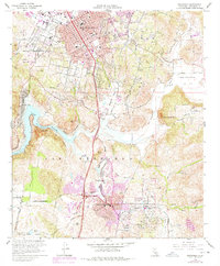
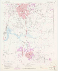
1968 Map of Escondido
USGS Topo · Published 1978About this map
The Escondido valley floor transitions from citrus and agricultural landscapes into suburban developments in this late 1960s study, with revisions reflecting the expansion of Rancho Bernardo and Green Valley. Urban growth is visible through the purple-tinted extensions of the Escondido corporate boundary and the emergence of residential clusters near Bernardo Center Drive. Historic land grants like Rancho Rincon del Diablo and Rancho San Bernardo define the regional geography, while vital water infrastructure including the San Diego Aqueduct and Lake Hodges supports the changing terrain. Educational footprints are well-marked by several local schools such as Central Sch and St Marys Sch. The transportation network is anchored by Interstate 15, which cuts a north-south path past Battle Mtn and provides the artery for the area's mid-century modernization.
Find a feature on this map
37 named features on this map. Tap any name to fly to it.
Don’t see what you’re looking for? This feature index may not catch every label — zoom into the map to look around manually.
Map Details
Editions of this 1968 Escondido Map
5 editions found
Other maps of this area

1893 · El Cajon
USGS Topo · 1:62,500

1893 · Escondido
USGS Topo · 1:62,500

1901 · Elcajon
USGS Topo · 1:62,500

1901 · Escondido
USGS Topo · 1:62,500

1901 · San Luis Rey
USGS Topo · 1:125,000

1903 · Cuyamaca
USGS Topo · 1:125,000

1903 · La Jolla
USGS Topo · 1:62,500

1903 · Elcajon
USGS Topo · 1:62,500

1903 · Ramona
USGS Topo · 1:125,000

1904 · Southern California Sheet No. 2
USGS Topo · 1:250,000