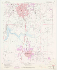
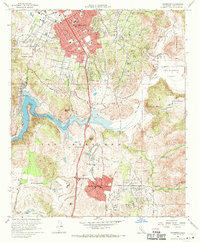
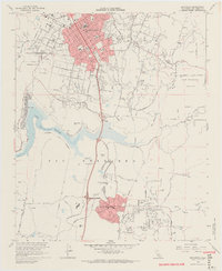
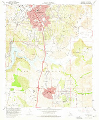
1968 Map of Escondido
USGS Topo · Published 1978About this map
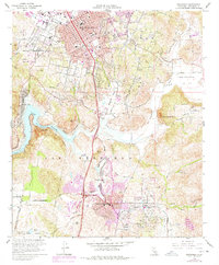
The growing agricultural and residential landscape of North County San Diego is documented here during a period of significant suburban transformation. Escondido serves as the primary urban center, with its downtown grid centered near the City Hall and schools like Juniper Sch. To the south, the planned community of Rancho Bernardo shows its early footprint, including the Rancho Bernardo Country Club and residential streets like Pastoral Rd and Acena Dr. This mid-century expansion is set against the backdrop of the older land grant boundaries of Rincon del Diablo (Snook).
Find a feature on this map
39 named features on this map. Tap any name to fly to it.
Don’t see what you’re looking for? This feature index may not catch every label — zoom into the map to look around manually.
Map Details
Editions of this 1968 Escondido Map
5 editions found
Other maps of this area

1893 · El Cajon
USGS Topo · 1:62,500

1893 · Escondido
USGS Topo · 1:62,500

1901 · Elcajon
USGS Topo · 1:62,500

1901 · Escondido
USGS Topo · 1:62,500

1901 · San Luis Rey
USGS Topo · 1:125,000

1903 · Cuyamaca
USGS Topo · 1:125,000

1903 · La Jolla
USGS Topo · 1:62,500

1903 · Elcajon
USGS Topo · 1:62,500

1903 · Ramona
USGS Topo · 1:125,000

1904 · Southern California Sheet No. 2
USGS Topo · 1:250,000