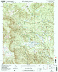
2005 Map of Escudilla Mountain
USGS Topo · Published 2006About this map
Escudilla Mountain dominates this high-altitude landscape along the border of Apache and Catron counties, marking the division between Arizona and New Mexico. The 2005 survey details a region managed through three distinct forest administrative zones: the Springerville, Quemado, and Alpine Ranger Districts. This overlap of jurisdictions highlights the area's significance as a managed forest resource, where the Apache National Forest and Gila National Forest converge. Water management for livestock and wildlife is central to the land's utility, evidenced by a dense network of catchments including Arizona Tank, Gibbons Lake Tank, and Steer Unit Tank. High peaks and ridges like Profanity Ridge and Turner Peak frame the protected Escudilla Mountain Wilderness, while the presence of the Escudilla Lookout underscores the ongoing importance of fire monitoring in these timbered highlands.
Find a feature on this map
57 named features on this map. Tap any name to fly to it.
Don’t see what you’re looking for? This feature index may not catch every label — zoom into the map to look around manually.
Map Details
Editions of this 2005 Escudilla Mountain Map
This is the sole edition of this map. No revisions or reprints were ever made.
Other maps of this area

1886 · St Johns
USGS Topo · 1:250,000

1892 · St Johns
USGS Topo · 1:250,000

1915 · Reserve
USGS Topo · 1:125,000

1918 · Reserve
USGS Topo · 1:125,000

1922 · Nutrioso
USGS Topo · 1:125,000

1954 · Clifton
USGS Topo · 1:250,000

1954 · Saint Johns
USGS Topo · 1:250,000

1957 · Clifton
USGS Topo · 1:250,000

1957 · Saint Johns
USGS Topo · 1:250,000

1958 · Clifton
USGS Topo · 1:250,000