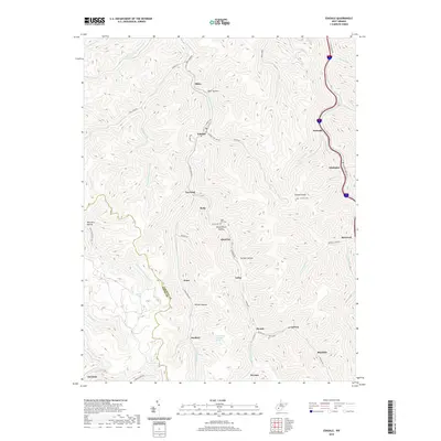
2019 Map of Eskdale
USGS Topo · Published 2019About this map
Cabin Creek and Paint Creek carve deep valleys through the plateau of southern West Virginia, defining the development patterns of Eskdale, Decota, and Whittaker. This survey shows a landscape heavily influenced by local industry and topography, where settlements like Quarrier and Laing are confined to narrow hollows. The presence of Fratix-Traer Company Spring and Powerhouse Hollow suggests a legacy of industrial infrastructure tailored to the steep terrain. For genealogists, the map preserves the locations of Sight Hill Cem, Johnson Cem, and Perry Cem, often situated on high ground near Johnson Knob. The intricate network of local routes, including Coal Fork Rd and Quarrier Dr, illustrates the connectivity between these small communities along the Kanawha County and Boone County border.
Find a feature on this map
67 named features on this map. Tap any name to fly to it.
Don’t see what you’re looking for? This feature index may not catch every label — zoom into the map to look around manually.
Map Details
Editions of this 2019 Eskdale Map
This is the sole edition of this map. No revisions or reprints were ever made.
Other maps of this area

1891 · Oceana
USGS Topo · 1:125,000

1891 · Raleigh
USGS Topo · 1:125,000

1893 · Oceana
USGS Topo · 1:125,000

1897 · Kanawha Falls
USGS Topo · 1:125,000

1897 · Raleigh
USGS Topo · 1:125,000

1898 · Oceana
USGS Topo · 1:125,000

1899 · Charleston
USGS Topo · 1:125,000

1900 · Kanawha Falls
USGS Topo · 1:125,000

1901 · Kanawha Falls
USGS Topo · 1:125,000

1902 · Raleigh
USGS Topo · 1:125,000