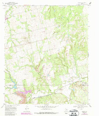
1969 Map of Eskota
USGS Topo · Published 1987About this map
Eskota and Palava anchor this 1960s landscape along the Fisher and Nolan County line. The area is defined by a significant transportation and industrial network, with the Missouri Pacific and Atchison Topeka and Santa Fe railroads traversing the southern section near Sweetwater Creek. These rail lines supported local extractive industries, evidenced by a Strip Mine and various Gravel Pits scattered near the watercourses. The drainage patterns are intricate, with Kildooquin Creek, Bitter Creek, and Cottonwood Creek carving through the terrain. Evidence of rural life is visible at the Cem near Palava, while benchmarks like Teetle and BM 1979 provide specific elevation points for surveyors and genealogists tracking land parcels in this part of West Texas.
Find a feature on this map
26 named features on this map. Tap any name to fly to it.
Don’t see what you’re looking for? This feature index may not catch every label — zoom into the map to look around manually.
Map Details
Editions of this 1969 Eskota Map
2 editions found
Other maps of this area

1893 · Roby
USGS Topo · 1:125,000

1893 · Sweetwater
USGS Topo · 1:125,000

1954 · Big Spring
USGS Topo · 1:250,000

1957 · Merkel
USGS Topo · 1:62,500

1957 · Noodle
USGS Topo · 1:62,500

1958 · Big Spring
USGS Topo · 1:250,000

1969 · Busby
USGS Topo · 1:24,000
1969 · Roby
USGS Topo · 1:24,000

1969 · Eskota
USGS Topo · 1:24,000

1969 · Sweetwater
USGS Topo · 1:24,000