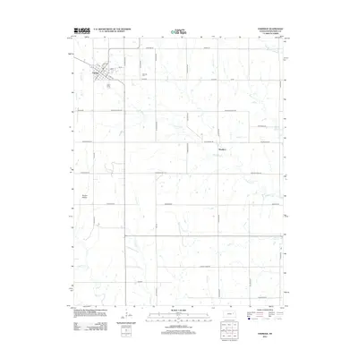
2012 Map of Eskridge
USGS Topo · Published 2012About this map
Eskridge sits as the primary hub of this eastern Kansas prairie landscape, where a grid of rural roads connects scattered settlements and agricultural lands. The town's layout is centered near the Po and features a residential grid bounded by S Main St and E 2nd Ave. To the northeast, the Eskridge Cem serves as a significant landmark for genealogical research. The terrain is defined by a dense network of drainages, including Dragoon Cr and Chicken Cr, which carve through the undulating fields.
Find a feature on this map
50 named features on this map. Tap any name to fly to it.
Don’t see what you’re looking for? This feature index may not catch every label — zoom into the map to look around manually.
Map Details
Editions of this 2012 Eskridge Map
This is the sole edition of this map. No revisions or reprints were ever made.
Other maps of this area

1885 · Eskridge
USGS Topo · 1:125,000

1889 · Burlingame
USGS Topo · 1:125,000

1889 · Eskridge
USGS Topo · 1:125,000

1894 · Eskridge
USGS Topo · 1:125,000

1894 · Burlingame
USGS Topo · 1:125,000

1947 · Lawrence
USGS Topo · 1:250,000

1950 · Lawrence
USGS Topo · 1:250,000

1952 · Harveyville
USGS Topo · 1:24,000
1952 · Dover
USGS Topo · 1:24,000

1955 · Hutchinson
USGS Topo · 1:250,000