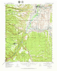
1953 Map of Espanola
USGS Topo · Published 1966About this map
Ancient Puye Dwellings and numerous unnamed ruins stand alongside the mid-century developments of the Rio Grande valley in this northern New Mexico survey. The landscape is defined by its complex land tenure, shown through the boundaries of the Santa Clara Pueblo Grant, San Ildefonso Pueblo Grant, and the Ramon Vigil Grant. While established communities like Espanola and Santa Cruz anchor the northern reaches, the map records the industrial footprint of the era through the D & R G W RR rail grade and several extractive sites, including the White Eagle Pumice Mine and various gravel pits.
Find a feature on this map
103 named features on this map. Tap any name to fly to it.
Don’t see what you’re looking for? This feature index may not catch every label — zoom into the map to look around manually.
Map Details
Editions of this 1953 Espanola Map
3 editions found
Other maps of this area

1889 · Santa Fe
USGS Topo · 1:125,000

1892 · Santa Clara
USGS Topo · 1:125,000

1894 · Santa Fe
USGS Topo · 1:125,000

1918 · Abiquiu
USGS Topo · 1:125,000

1951 · Agua Fria
USGS Topo · 1:24,000

1952 · Santa Fe
USGS Topo · 1:24,000

1952 · White Rock
USGS Topo · 1:24,000

1952 · Frijoles
USGS Topo · 1:24,000

1952 · Puye
USGS Topo · 1:24,000

1952 · Montoso Peak
USGS Topo · 1:24,000